
Making it Safe for All to Share the Roads in Mercer County
Last week, we talked about some of our favorite walkable and bikeable places in Mercer County and Ocean County. You can read more about it here.
In many communities, promoting and building the infrastructure to support active travel has been an uphill battle. While the dream is to have continuous, connected, well-maintained sidewalks and bike lane networks, the reality is that it often doesn’t happen all at once. This is one of the biggest obstacles in weaning off car-dependency. To support active transportation, we need to prioritize inclusive street design, especially projects that make it safer and easier to cycle and walk in our communities.
With the blue sign the council have provided an answer to their own question.
📷 @MrHappyCyclist pic.twitter.com/ReTi5X84lU
— Jon Owen (@anotherJon) March 20, 2022
Moving the United States from a car required mentality to a car optional society feels like an overwhelmingly impossible task. Sometimes I wonder if my efforts are even worth it. But then I think about all the struggles people have endured before me so I could have a better life.
— Jerome Alexander Horne (@jahorne) March 23, 2022
"Breaking car culture" ≠ "Everyone gets rid of their cars." It means "Stop letting cars be the dominating force of our transportation planning and politics." There's nothing inconsistent with owning a car and supporting polices that make it easier for people to not use them.
— Doug Gordon (@BrooklynSpoke) March 22, 2022
As the saying goes, “a journey of a thousand miles begins with a single step.” It can take time for these pieces to slowly come together, and so we march on!
This week, we are celebrating projects and initiatives that encourage community engagement in planning, encourage Complete Streets, and make it safer and more convenient for pedestrians, cyclists, rollers, skaters, and transit-riders to get around.
Lawrence Township
In March 2022, Lawrence Township received $80,000 from the New Jersey Department of Transportation (NJDOT) for safety improvements on Craven Lane. The grant is provided through the NJTOD’s Transportation Trust Fund, a program that provides funding for communities throughout the state to advance transportation projects without burdening local taxpayers. Funding is provided through the state’s Local Aid and Infrastructure Fund program. The Craven Lane Safety Improvement Project has several components to it, including installing a flashing beacon at the Johnson Trolley Line intersection, replacing sidewalks at the George Street-Craven Lane

The Johnson Trolley Line Trail in Lawrence Township by Sheena Chi (2009)
intersection, and adding accessible curb ramps and high-visibility crosswalks.
According to municipal officers, the project will improve improving walking and biking routes to Lawrence Elementary School between the post office and the Johnson Trolley Line.
To become truly walkable and bikeable, many communities have to focus on gradual and continuous change while never losing sight of their goals. Lawrence is one such community. Previously, in 2016, the town received a $6.6M federal grant for the Route 1 Business from Brunswick Circle to Lake Drive Improvements Project. The project ran from 2016 to 2018 and addressed safety improvements to create a more pedestrian-friendly intersection. The town removed a traffic signal and created a median as well as a three-leg, two-lane roundabout at the Route 1 Business and Whitehead Road intersection to calm traffic speeds and improve pedestrian safety.
Trenton
In August 2021, muralist and graffiti artist Leon Rainbow led a team of volunteers in repainting the city’s iconic rainbow crosswalk at the intersection of Warren and Front Street. Among the volunteers was Maria Richardson, the director of Trenton’s Recreation, Natural Resources & Culture department. The rainbow is a symbol of LGBTQ+ pride and was originally created during the city’s first Ciclovia for Trenton’s Pride Festival in 2019.
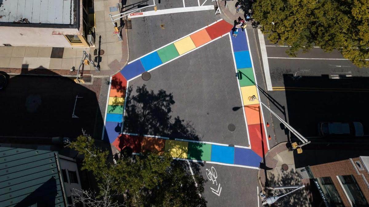
Trenton’s Rainbow Crosswalk by Leon Rainbow (2019)
“Ciclovia” means bikeway in Spanish, and refers to Ciclovias or Open Streets Festivals that temporarily open streets to people and close them to cars. Learn how to pronounce it correctly here. Ciclovia is a movement that originated in Bogota, Colombia back in the 1970s, but has been adopted by many cities in the United States including New Jersey. During a ciclovia, pedestrian traffic replaces car traffic and the streets become ‘paved parks’, where people of all ages, abilities, and backgrounds can come out and improve their health and spend time with other community members. Without cars on the street for the day, Ciclovia provides an opportunity for neighbors to (re)connect, have fun, and talk about ways their streets can become important public health solutions.
Watch this video by the Tri-State Transportation Campaign, one of the partners who made Ciclovia happen in Trenton.
Princeton
The Witherspoon-Jackson Neighborhood Association recently convened to talk about street trees and landscaping, as well as some detailed thinking about the construction of Phase 2 of the Witherspoon Corridor Improvements. The plan presented included possible designs for a bike lane from Green Street to Franklin Avenue, in the southbound, or uphill lane headed toward Nassau Street.
The construction of the bike lane would require the removal of a utility post, the burying of utility lines, the removal of 11 (out of the 31 existing) parking spaces, and several trees lining the sidewalks. Another thing to consider is that Witherspoon Street currently only provides 11 feet per traffic lane. The Department of Transportation’s “Roadway Design Manual” sets the minimum width of a traffic lane in an urban setting at 12 feet, except in traffic calming areas, while the more recent guide by National Association of City Transportation Officials (NACTO) recommends a default of 10-foot lanes. See the full language from the 2008 DOT guide below:
“While lane widths of 12 feet are desirable on land service highways, circumstances may necessitate the use of lanes less than 12 feet. Lane widths of 11 feet in urban areas are acceptable. Existing lane widths of 10 feet have been provided in certain locations where right of way and existing development became stringent controls and where truck volumes were limited. However, new or reconstructed 10 foot wide lanes would not be proposed today, except in traffic calming areas.” (NJDOT Roadway Design Manual, 2015)
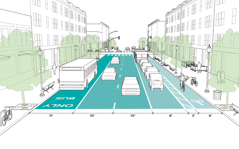
Lane width redesign suggestions from the NATCO’s Urban Street Design Guide
Surveys filled out by Witherspoon-Jackson residents have shown a desire for slower traffic speeds and improvements to pedestrian safety and experience. In addition to other traffic calming measures like raised crosswalks and “bumped” out sidewalks, narrower traffic lanes and more bike lanes may be in line with the neighborhood’s vision for better pedestrian and cycling infrastructure.
Mercer County
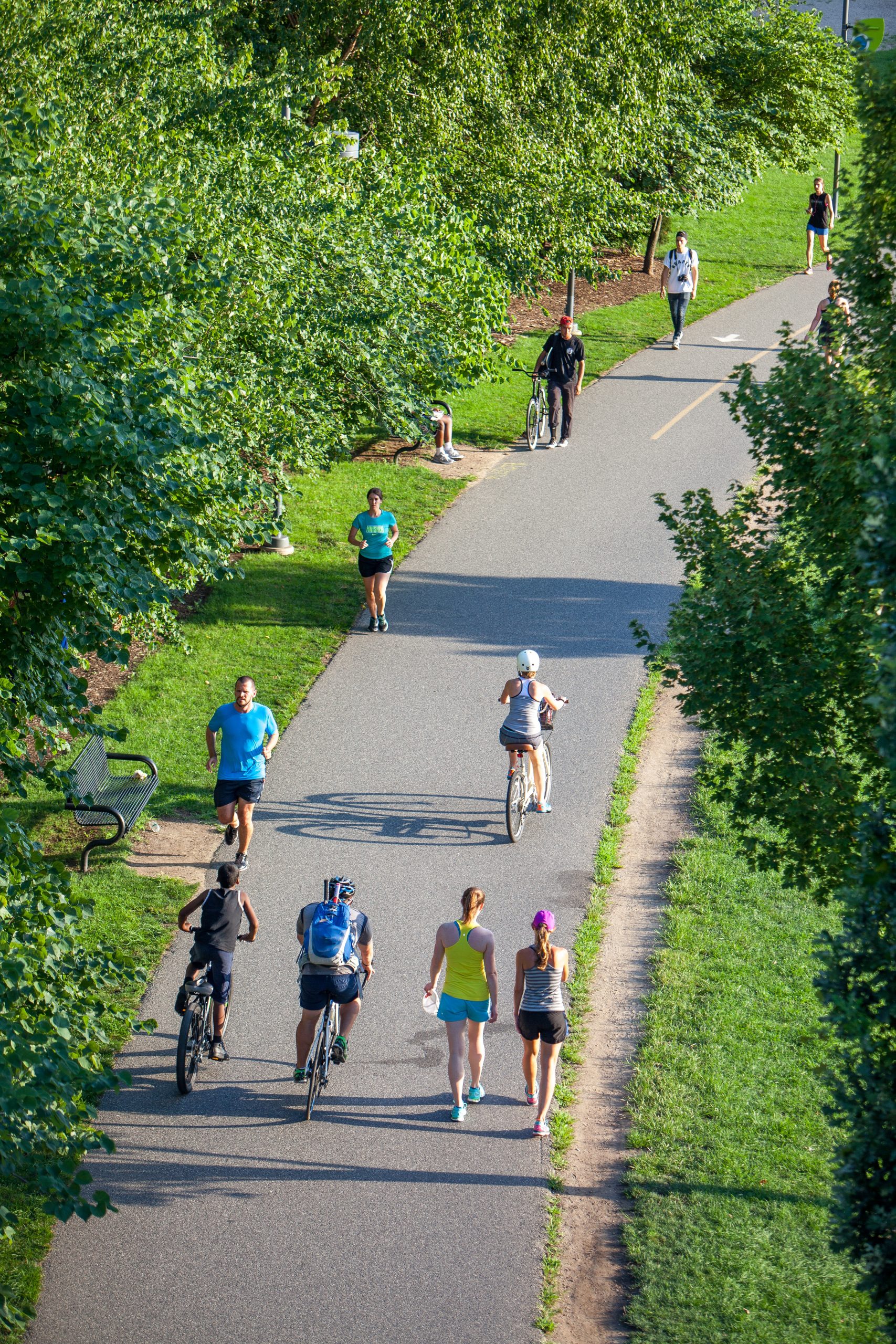
An example of a multi-use path by James Lewis (2020) via Unsplash
In 2019, Mercer County received a $2.3M grant to design and construct the Mercer County Great Western Bikeway, a bicycle route along County Route 546. The funding is from the Regional Transportation Alternatives Program, was issued by the New Jersey Department of Transportation (NJDOT).
County Route 546 is also known as Washington Crossing-Pennington Road, Penningon-Lawrenceville Road, and Franking Corner road. The Mercer County Great Western Bikeway will establish 17.5 miles of routes suitable for bicycle travel. It help maximize connectivity to existing trail and bike networks in the county. According to County Executive Brian M. Hughes, the bikeway will “provide bicycle access to many neighborhoods and recreational facilities in Ewing, Hopewell Township, Pennington and Lawrence” and was inspired by the impact of the immensely popular Lawrence-Hopewell Trail. The excerpt below is taken directly from the Mercer County website:
The County is currently advancing Segment 1, which runs on CR 546 from Hopewell Township to Lawrence Township. This 10-mile-long east-west route will further expand the County’s promotion of complete streets and bike travel. It will provide a direct link between two branches of the D&R Canal State Park Trail: at Washington Crossing State Park to the west and Bakers Basin Road to the east. It will also connect to additional regional trails, preserved open spaces, parks and other destinations.
Future segment routes include a branch to Ewing Township via Scotch Road (CR 611), which will terminate at the Ewing Town Center, as well as a branch to downtown Pennington Borough via Main Street (CR 640) and East Delaware Avenue (CR 624). This bikeway complements several other municipal and County bike/trail efforts underway and will serve as a spine for the northwestern part of the County. The Great Western Bikeway will ultimately establish 17.5 miles of bikeable shoulders, bike lanes, buffered bike lanes, two-way cycle tracks, and multi-use paths on Mercer County highways that are already relatively well-suited for bicycle travel. (Mercer County Press Release and Newsletter)
We are constantly inspired by the hard work that our Mercer County communities are doing to improve walking and biking experiences in their communities. Did we miss anything? We’d love to hear about projects in your community that you find exciting!
Sources:
- https://patch.com/new-jersey/lawrenceville/lawrence-township-gets-80-000-craven-lane-project
- New Jersey Transportation Trust Fund Authority – Overview (state.nj.us)
- https://www.nj.com/mercer/2021/08/rehabbed-rainbow-crosswalk-in-nj-city-shines-with-pride-once-more.html
- Trenton Holds its First Ciclovia | New Jersey Future (njfuture.org)
- https://patch.com/new-jersey/princeton/mercer-county-gets-2-3m-grant-add-more-bike-routes
- https://www.tapinto.net/towns/princeton/sections/planning-and-zoning/articles/a-farewell-to-the-spring-blooms-of-upper-witherspoon-street-a-glimmer-of-hope-for-a-bike-lane-on-lower-witherspoon
- https://www.state.nj.us/transportation/about/press/2017/060917a.shtm
- https://patch.com/new-jersey/princeton/mercer-county-gets-2-3m-grant-add-more-bike-routes
- https://www.mercercounty.org/home/showpublisheddocument/22941
- https://content.govdelivery.com/accounts/NJMERCER/bulletins/30cb3da